City Ride
Category
case study
/
Year
2026
A case study where I improved pick-up accuracy in the driver app by using image view and street view, which helped reduce order cancellations.
Improvement in
Avg. Pickup time
35%
62%
Reduction in
Support tickets
Note - Projected impact (Based on usability testing with 18 drivers)
Jan 2026 - Feb 2026
Improving Pickup Accuracy For Drivers
41%
Reduction in
Cancellation rate

The CityRide driver app is where navigation, rider details, and on-ground reality have to line up especially around stations, malls,
and multi gate venues where a wrong stop costs everyone time. This write up walks through how we used data, field research,
and iterative UI to reduce that friction at pickup.
Overview
🌍 Setting the scene
Complex pickup zones crowded kerbs, unclear pins, and unclear landmarks made it hard for drivers to align what they saw outside with what the app implied. That gap showed up in longer searches, more support churn, and riders walking farther than they should.
How might we help drivers find their passengers more accurately in complex pickup zones?
🧩 The Problem
Our data showed a troubling pattern. Drivers were spending over twice as long finding passengers in these zones.
23%
Cancellation
Transit hub
40%
Help Tickets
Transit hub
8.5 m
Cancellation
Transit hub
The goal was clear:
Improve pickup
accuracy
for drivers
in crowded location
for drivers
in crowded location
Setting out to solve
🚖 The Field Work
To understand the real problem, I did research on the ground for three intense days across four major hubs observing, interviewing 18 drivers, and listening to hundreds of micro-stories from the people behind the wheel.
3 Days
Research
4 Hubs
Transits
18
Drivers
I learned that:
• GPS alone couldn't cope with the multi-layered layouts of stations and airports.
• Drivers were guessing based on intuition, not information.
• Many simply wished they could “see where the rider actually is.”

One driver summed it up perfectly:
“Show me a photo of where to go - I'll find them faster than any map can.”
Rushi, Auto Driver
💡 Reimagining the Pickup Experience
I reframed the problem not as a navigation issue, but as a context issue. The insight was simple yet powerful: seeing the location is more reliable than following it. That single insight sparked the hypothesis:
“If drivers can see the pickup point through real-world
visuals, we can dramatically improve pickup accuracy.”
The solution
Introduce street view or
image of pick-up location
This feature shows a view of the pick-up location directly in the app, helping drivers visually identify exactly where to meet passengers at busy or confusing places. It provides real-world context such as nearby landmarks, building entrances, or special waiting zones for greater accuracy and confidence during pickups.

✨ My Vision as a UX Designer
Instead of treating this as a minor feature addition, I saw it as an opportunity to redefine the driver experience both visually and functionally. I proposed creating a Visual Pickup Experience, a holistic redesign that blended real-world imagery, contextual cues, and conversational communication.
This required more than UI tweaks it called for a new design language built on three user needs that I have defined:
Confidence to arrive
at the pickup location
For a driver, confidence doesn't come from the map it comes from certainty. In crowded transit hubs, every moment of hesitation
choosing the right gate or lane adds delays and frustration.
Save time, stress
and fuel
Helping drivers save time, stress, and fuel meant designing for efficiency fewer wrong turns, quicker decisions, and smoother pickups that made every trip feel effortless.
A handshake between driver & customer
Creating a handshake between driver and customer meant building trust through clearer communication making it easier for both to find each other quickly and confidently.



The redesign
Here's how we transformed the experience:
1. Visual Intelligence on the Map
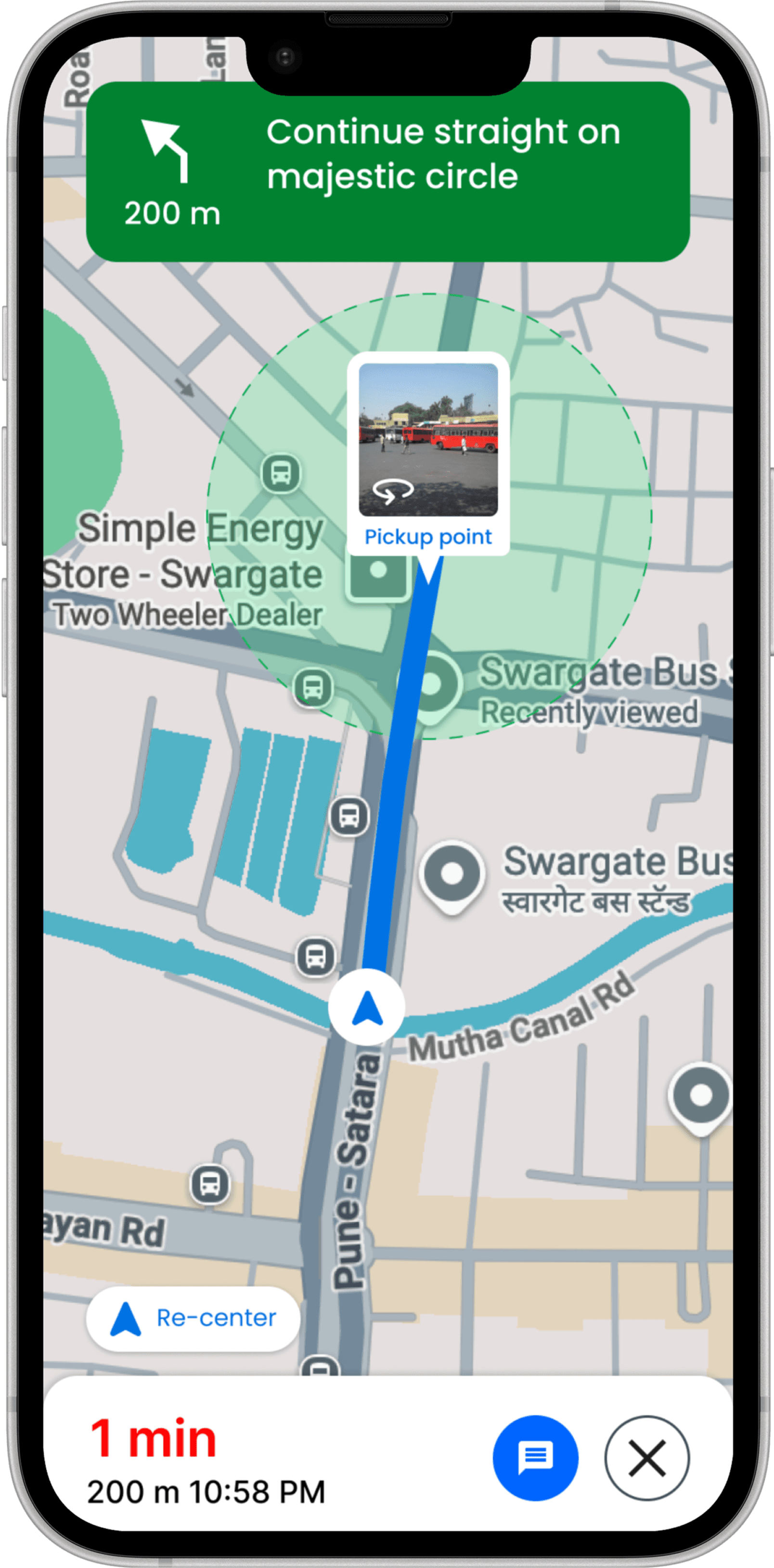
Integrating an Image View within the Pickup Screen helps drivers identify exact pickup points, bridging the gap between digital navigation and real-world context to reduce confusion.

2. Street View of the pick up spot
The screen attempts to load immersive 360° Street View when available, or falls back to a static Image View photo so drivers have a visual reference regardless of connectivity.


3. Navigation Reimagined
As the driver approaches the pickup point, the default navigation marker seamlessly transitions into a Street View marker. The driver can click the marker, and the street view of the exact pickup spot appears for quick visual confirmation.

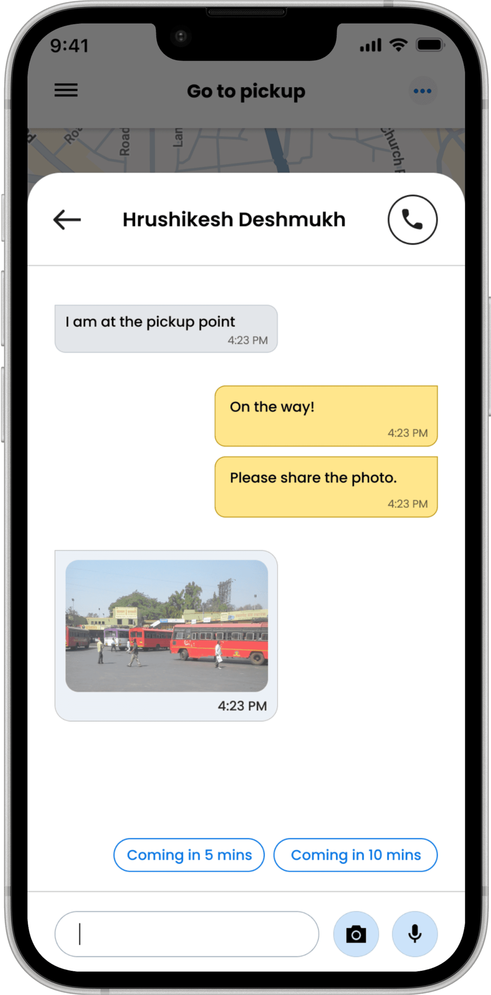
4. Photo & Voice Message Integration on Chat
The Photo and Voice Message Integration in chat enables drivers and passengers to communicate more effectively during pickups. Drivers can send a quick photo of their exact location or a short voice message when typing isn't convenient, reducing misunderstandings and delays. This feature adds a personal, real-time layer to communication, helping both parties identify each other faster and complete pickups smoothly even in crowded or noisy environments.


5. All screens
Here are the screens that I designed as part of this initiative.

Impact & Result
🧪 User testing
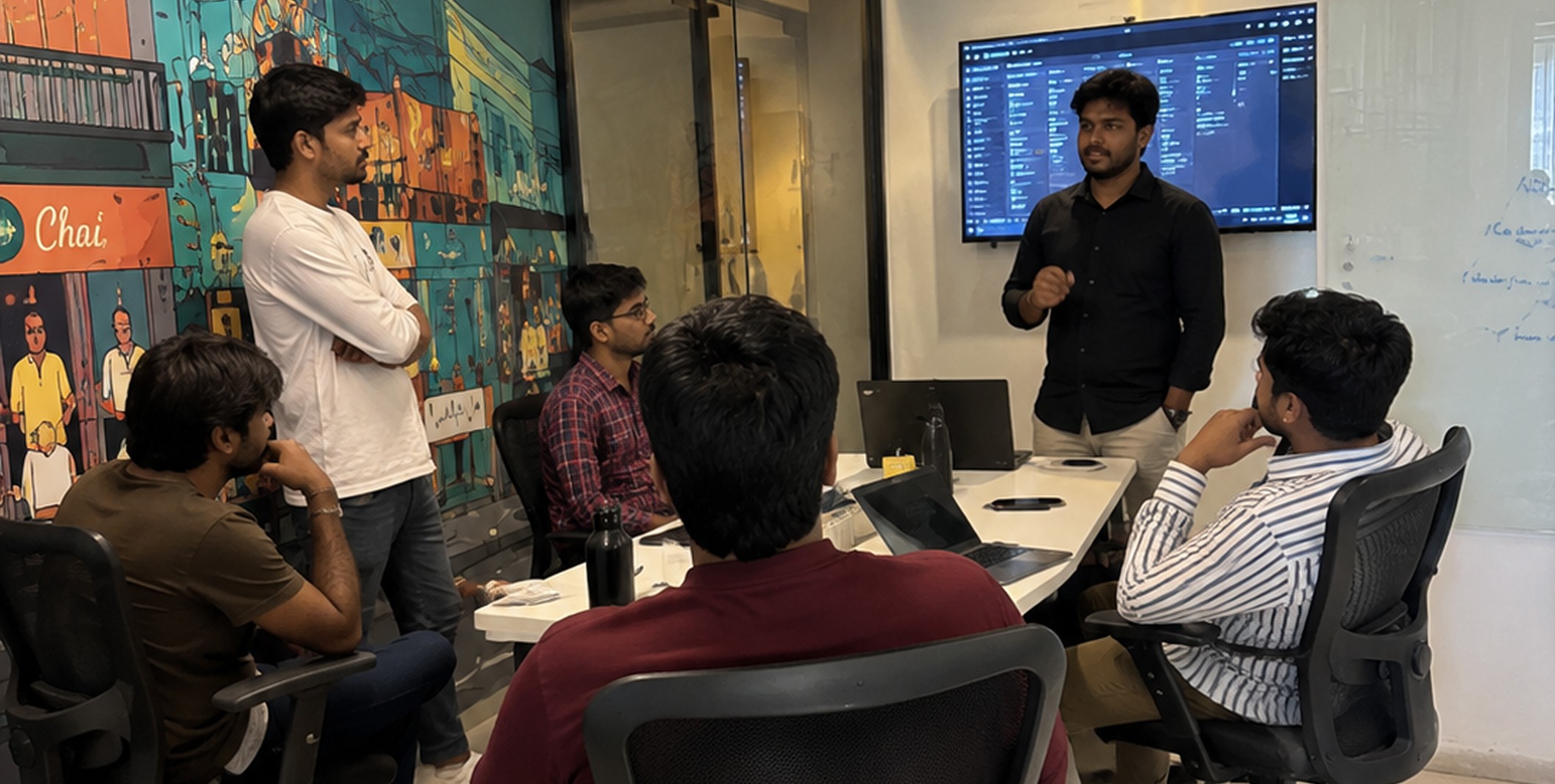
I conducted usability testing with 10 active drivers who frequently operate around major transit hubs. Each participant completed simulated pickups using the new Pickup View prototype on their own devices.

• 9 out of 10 drivers successfully identified the correct pickup spot without external help.
• 7 drivers mentioned the street image gave immediate clarity about where to stop.
• 3 drivers operating in areas without Street View said the static photo fallback still provided enough visual context.
🌟 Key outcomes
• 100% of participants said they would prefer this new view for crowded locations.
📋 Proposed rollout strategy
This is a case study the feature wasn't shipped to production. I'd recommend a phased rollout, starting with pilot deployments in high-density transit hubs where pickup complexity and volume are greatest. Early pilots would validate improvements in pickup accuracy, reduced cancellations, and driver feedback before gradually expanding to broader coverage. That step-by-step approach would help ensure performance stability, allow quick iteration from field feedback, and build confidence among stakeholders before a wider release.

🧠 Closing thought
This project began as a minor feature request but evolved into a defining moment for the design team. By pushing beyond the requirement, I helped reimagine the driver experience and set a new creative standard for future CityRide Captain products.
“Sometimes, the most meaningful design happens when you
go beyond what's asked - and build what's truly needed.”